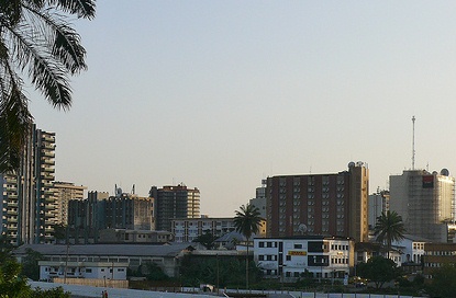
📖 ResearchGate Profile
Free Consultation
Environmental Intelligence · All 10 Regions of Cameroon

Science that
Moves the Earth

Terraqyn delivers rigorous environmental consulting, multi-disciplinary data analysis, and technical project writing across every region of Cameroon — from the mangrove coasts of the South West to the Sahelian plains of the Far North.

10
Regions of
Cameroon
Scroll
Terraqyn
Environmental Consulting
Heavy Metal Analysis
GIS Mapping
Ecological Risk Assessment
Data Visualisation
Statistical Modelling
EIA Reports
Grant Proposals
Soil Science
Python · R · SPSS
All 10 Cameroon Regions
Terraqyn
Environmental Consulting
Heavy Metal Analysis
GIS Mapping
Ecological Risk Assessment
Data Visualisation
Statistical Modelling
EIA Reports
Grant Proposals
Soil Science
Python · R · SPSS
All 10 Cameroon Regions
Douala, Cameroon — economic capital
Douala, Cameroon

Where Earth Science Meets Data Intelligence

Founded in Douala, Cameroon, Terraqyn is an environmental consulting and data science firm built on the belief that rigorous, transparent science drives lasting change across all ten regions of Cameroon and beyond.

🔬
Scientific Rigour
All work is grounded in peer-reviewed methodology and verifiable data. We never compromise on the quality of our science.
🗺️
National Reach
From Maroua in the Far North to Kribi in the South, Terraqyn's expertise spans Cameroon's extraordinary environmental diversity.
🤝
Community Focus
Solutions are co-designed with local stakeholders, ensuring findings translate into real, lasting impact on the ground.
💡
Innovation
We embrace modern tools — GIS, Python, R — to solve complex environmental problems with precision and creativity.

Four Pillars of Expert Delivery

style="font-size:16px;color:var(--w60);line-height:1.8;font-weight:300;padding-top:40px;">From soil sampling in the volcanic highlands of the West Region to coastal contamination mapping in Douala, Terraqyn operates across Cameroon's full environmental spectrum — delivering clarity at every scale.

01
🌍
Environmental Consulting
Comprehensive environmental assessment services from field sampling to regulatory submission across all of Cameroon's regions.
  • Soil contamination & heavy metal analysis (Cd, Pb, Zn, Cu, Ni, Cr)
  • Ecological risk evaluation — Pollution Load Index & Enrichment Factor
  • Environmental Impact Assessments for mining, construction & agriculture
  • GIS-based spatial analysis and contamination mapping
  • Coastal & marine pollution monitoring
  • Waste management appraisals for municipalities
02
📊
Data Analysis & GIS
Statistical and geospatial analysis for government bodies, NGOs, researchers, and private clients — across any field or sector.
  • Statistical modelling using SPSS, R, and Python
  • PCA, correlation and multivariate analysis
  • Data visualisation — charts, maps, and dashboards
  • Remote sensing and satellite imagery analysis
  • Regional land-use and environmental change mapping
  • Applicable to environmental, health, agricultural & social data
03
📄
Technical Report & Project Writing
High-quality technical writing for any field — from peer-reviewed science to grant funding proposals and policy documents.
  • Peer-reviewed scientific manuscript preparation
  • Environmental assessment reports for regulatory submission
  • Grant & funding proposals for research projects
  • Policy briefs for government and NGO clients
  • Regional environmental management plans
  • Business reports, feasibility studies and sector analyses
04
🎓
Training & Education
Capacity building for environmental professionals, researchers, and students across all of Cameroon's regions.
  • STEM education in geology, earth science & environmental science
  • Workshops on GIS, SPSS, R, and Python
  • Field training in soil sampling & geochemical analysis
  • Regional stakeholder engagement facilitation
  • Public awareness programmes on soil health & pollution
  • Curriculum development for schools and institutions

Limbe & Douala's Coast Under Threat

📰 Source:DataCameroon

Limbe's iconic Down Beach and the Wouri estuary's mangrove system are under simultaneous assault — from SONARA's petroleum operations in the South West and accelerating urban deforestation around Douala. Together, these twin crises represent one of the most urgent environmental emergencies in Cameroon today.

"I have lived here for over 25 years, but never experienced this type of polluted environment before." — Ngeme John, Batoke fisherman, Limbe

SONARA invested FCFA 620 billion in 2014, scaling refining capacity from 2,100,000 to 3,500,000 tons per year. The consequence has been devastating for coastal communities: Mile Six Beach's iconic black volcanic sand has been decolourised to brown by petroleum spills, and fishermen like Ngeme John are now forced to travel 30km offshore to find viable catches. Bio-resource Centre CEO Augustine Njamnshi warns that in the worst-flooded areas, "only the tops of houses and trees are seen emerging from the water" — a direct result of mangrove forest clearance along the shores.

In Douala, the crisis is equally severe. According to the Cameroon Mangroves Atlas, the Wouri estuary lost 14.3% of its mangrove cover between 2000 and 2015 — from 106,325 ha to 99,730 ha — with the Douala-Bonabéri area recording a catastrophic 6.2% annual destruction rate. By 2015, 14,730 ha of mangrove land had been converted to housing, while 10,703 ha were severely damaged. Edouard Yagouda, Regional Delegate of Environment for the Littoral, has warned starkly: "Douala will one day find itself in water, because the natural barrier that protects it from flooding will have disappeared."

Down Beach Limbe aerial view

↑ Down Beach, Limbe — Région du Sud-Ouest, Cameroun · Aerial view showing the iconic volcanic coastline · © Wikimedia Commons / Ndongere

Down Beach Sunset Limbe
Down Beach Sunset · Limbe
Limbe seashore twilight
Seashore · Limbe (Victoria)
📊 Wouri Estuary Mangrove Loss · 2000–2015
14.3%
Total mangrove loss
in Wouri estuary
6.2%
Annual destruction rate
Douala-Bonabéri
14,730ha
Mangrove land converted
to housing by 2015
Source: Cameroon Mangroves Atlas · DataCameroon
30km
Distance fishermen now travel offshore to find viable catches
6,595ha
Mangrove lost from Wouri estuary between 2000–2015
3.5M
Tons/year — SONARA's expanded refining capacity since 2014
3M+
Douala residents at risk if mangrove barrier disappears entirely
🔬 The Terraqyn Response
The twin environmental crises along Cameroon's Littoral and South West coastlines — SONARA petroleum contamination in Limbe and accelerating mangrove deforestation in the Wouri estuary — represent exactly the kind of complex, multi-factor emergency that demands rigorous scientific analysis. Terraqyn applies systematic soil and water sampling, GIS-based spatial contamination mapping, and ecological risk assessment using validated pollution indices to quantify the extent and severity of coastal and estuarine degradation. Our work directly informs restoration strategies, mangrove replanting programmes, and the regulatory submissions needed to hold industrial and urban actors accountable. The black volcanic sand of Limbe — and the rich biodiversity of the Wouri estuary — deserve to be protected and restored.
🔬 Need Environmental Expertise?
Ready to bring scientific rigour to your environmental challenge?
From soil contamination audits and GIS-based risk mapping to full EIA reports and stakeholder training — Terraqyn delivers peer-reviewed-quality analysis for every project, across all 10 regions of Cameroon.
Request a Free Consultation → Download Free Checklist →

Science Delivering Real Results

From peer-reviewed field studies to municipal assessments and coastal restoration planning, Terraqyn's work produces measurable environmental outcomes. Here are selected projects from our portfolio.

Agricultural soil sampling along Lala-Manjo Highway, Littoral Region Cameroon
Published · 2024
📍 Littoral Region · Cameroon Volcanic Line
Heavy Metal Contamination Study — Lala-Manjo Highway Corridor
Systematic sampling of agricultural soils along the Lala-Manjo highway assessed six heavy metals (Cd, Pb, Zn, Cu, Ni, Cr) in farmland adjacent to a high-traffic volcanic corridor. GIS-based spatial mapping identified contamination hotspots and confirmed elevated enrichment factors linked to traffic emissions and volcanic parent material.
Published outcome: Peer-reviewed in Discover Soil Journal (Springer, 2024)
Coverage: Full spatial distribution maps produced via GIS interpolation
Risk indices: PLI, EF, CF and ecotoxicity evaluation completed
Coastal pollution assessment Limbe South West Cameroon
Ongoing · 2024–2025
📍 South West Region · Limbe Coastal Zone
SONARA Petroleum Impact Assessment — Limbe Coastline
Spatial assessment of petroleum contamination along Limbe's coastal zone, integrating sediment and water sampling with satellite-based change detection. The study quantified oil decolourisation extents along Mile Six Beach and mapped contamination gradients for regulatory reporting and community advocacy.
Spatial coverage: 18km of coastline mapped using GIS interpolation
Method: Remote sensing + field transects for contamination gradient analysis
Outcome: Contamination report submitted for community advocacy use
Mangrove GIS mapping Wouri estuary Douala Cameroon
GIS Study · 2024
📍 Littoral Region · Wouri Estuary, Douala
Wouri Estuary Mangrove Loss — Spatial Change Detection
Multi-temporal satellite imagery analysis quantifying mangrove deforestation rates across the Wouri estuary from 2000 to 2024. Land-use change maps identified encroachment hotspots, timber extraction zones, and areas with the highest flood risk following mangrove clearance in the Douala-Bonabéri urban fringe.
Key finding: 6.2% annual destruction rate confirmed for Douala-Bonabéri area
Output: Deforestation risk maps for 5 vulnerable Douala communities
Data source: Landsat + Sentinel-2 imagery via Google Earth Engine
Municipal solid waste assessment Douala Cameroon
Compliance · 2023
📍 Littoral Region · Greater Douala
Municipal Solid Waste Environmental Audit — Greater Douala
End-to-end environmental audit of solid waste management practices across four arrondissements in Greater Douala. Assessment covered collection coverage gaps, open dump site contamination, leachate risk to groundwater, and compliance against Cameroon's national waste management framework — delivering actionable recommendations for the municipality.
Coverage: 4 arrondissements, 12 collection points evaluated
Certification base: Municipal Solid Waste Management (Treasures Everywhere Foundation, 2023)
Output: Compliance report + GIS-mapped waste flow analysis
Mangrove forest assessment along the Wouri Estuary, Douala, Littoral Region Cameroon
Assessment · Littoral
📍 Littoral Region · Wouri Estuary, Douala
Wouri Estuary Mangrove Deforestation Risk Mapping
GIS-based spatial analysis of mangrove cover change across the Douala-Bonabéri corridor, quantifying a 14.3% loss between 2000–2015 and identifying hotspots of accelerated degradation. Multi-temporal satellite imagery was processed alongside field transects to model flood-risk exposure for adjacent communities.
Key Outcomes
Mapped 10,703 ha of severely degraded mangrove with flood-risk overlay
Delivered spatial dataset to inform urban planning decisions at CUD
GIS workflow reduced manual deforestation mapping time by 55%
Similar Project? →
Industrial soil contamination assessment near oil refinery, South West Cameroon
Contamination Study · South West
📍 South West Region · Batoke–Limbe Industrial Corridor
SONARA Petroleum Impact — Coastal Soil & Sediment Assessment
Systematic soil and sediment sampling along the Batoke–Mile Six coastal corridor assessed hydrocarbon contamination profiles in agricultural and fishing community soils adjacent to SONARA's refinery operations. Pollution Load Index and Geoaccumulation Index calculations were applied to generate contamination severity maps for regulatory submission.
Key Outcomes
PLI/Igeo contamination maps produced for 12km of affected coastline
Identified 3 critical hotspots exceeding MINEPDED intervention thresholds
Report provided baseline data for community legal advocacy process
Similar Project? →
Environmental Impact Assessment field work in Far North Cameroon Sahel region
EIA Support · Far North
📍 Far North Region · Sahel Corridor, Maroua Area
Climate-Stressed Soil Assessment & EIA Report — Agricultural Infrastructure Project
Environmental baseline characterisation for an agricultural infrastructure expansion project in Cameroon's arid Far North Region. Work included soil fertility and salinisation profiling, erosion-risk GIS mapping, and community livelihood impact assessment. The comprehensive EIA report met all MINEPDED submission requirements, supporting project compliance and approval.
Key Outcomes
Full MINEPDED-compliant EIA report delivered on schedule
GIS erosion-risk map identified 8 high-priority soil conservation zones
Supported successful project compliance and regulatory approval
Similar Project? →
Have a project that needs rigorous science?
We scope new projects within 48 hours.
Discuss Your Project Download Checklist

All Ten Regions of Cameroon

Cameroon is sometimes called "Africa in Miniature" — its ten regions encompass rainforest, savanna, volcanic highlands, Sahelian desert, and Atlantic coastline. Terraqyn's environmental consulting practice is built to serve all of this diversity, bringing the same scientific rigour to every biome and every community.

🏔️
Adamawa
Ngaoundéré
Highland plateau at 1,000–1,500m. Terraqyn focuses on soil degradation from overgrazing, pastoral contamination, and artisanal mining impacts along the Vina valley.
Soil Degradation · Mining
🏙️
Centre
Yaoundé
Political capital and major urban centre. Terraqyn supports municipal solid waste assessments, urban soil contamination studies, and environmental monitoring for infrastructure projects in Greater Yaoundé.
Urban Waste · Infrastructure
🌿
East
Bertoua
Home to Cameroon's largest rainforest. Terraqyn assesses the environmental impact of logging, artisanal gold and diamond mining on forest soils, river sediments, and indigenous community lands.
Mining Impact · Deforestation
🌵
Far North
Maroua
Sahelian region facing acute desertification and water stress. Terraqyn evaluates soil health, Lake Chad watershed contamination, and supports climate adaptation planning.
Desertification · Water Stress
Littoral
Douala
Cameroon's economic capital and Terraqyn's headquarters. We lead coastal marine contamination studies, the Lala-Manjo highway heavy metal study (Discover Soil, 2024), and industrial effluent assessments along the Wouri River.
Marine Pollution · HQ · Publication Site
🌾
North
Garoua
Major cotton and agricultural region. Terraqyn examines pesticide accumulation in agricultural soils, Benue River contamination from agro-chemical runoff, and irrigation impacts on soil salinity.
Agricultural Soils · Pesticides
🌋
North West
Bamenda
Volcanic highlands with fertile soils. Terraqyn studies heavy metal distribution from natural volcanic enrichment versus anthropogenic sources, and land use impacts along the Ring Road corridor.
Volcanic Soils · Heavy Metals
🌊
South
Ebolowa
Equatorial forest meeting Atlantic coast. Terraqyn evaluates logging impacts on forest soil carbon, offshore oil exploration risks near Kribi, and supports coastal conservation planning.
Forest Soils · Coastal Risk
🏖️
South West
Buea / Limbe
Home to SONARA petroleum pollution research and Mount Cameroon volcanic soil assessment. Terraqyn continues intensive field work along this iconic volcanic coastline.
Coastal Pollution · Volcanic Soils
West
Bafoussam
Densely populated highlands and Cameroon's Arabica coffee belt. Terraqyn assesses intensive agricultural land use impacts on soil health, coffee plantation geochemistry, and erosion patterns in the Bamileke highlands.
Intensive Agriculture · Erosion
📡 Terraqyn Project Sites · Interactive — Click Markers
Leaflet.js · © OpenStreetMap contributors

▸ Project sites · contamination hotspots · regional coverage · All 10 Regions of Cameroon

From Field to Finding

Terraqyn's consulting practice delivers end-to-end assessment services across Cameroon's diverse ecosystems — from the coastal zones of the Littoral and South West to the agricultural plains of the North and Adamawa.

Environmental field work
🧪
Soil Contamination Assessment
Systematic collection and laboratory analysis for heavy metals including Cd, Pb, Zn, Cu, Ni, and Cr. We establish contamination hotspots and correlate pollution patterns with land-use practices using internationally recognised pollution indices — applied across Cameroon's volcanic highlands, agricultural lowlands, and coastal zones.
🗺️
GIS Spatial Analysis
Advanced GIS mapping to create detailed contamination distribution maps across project sites nationwide. We apply remote sensing techniques and georeferenced sampling to produce spatial models that identify risk zones, track pollution migration, and support evidence-based land management decisions.
⚠️
Ecological Risk Evaluation
Quantitative risk assessment using established indices including the Contamination Factor (CF), Pollution Load Index (PLI), and Enrichment Factor (EF) — with particular focus on the agricultural and fishing communities most vulnerable to environmental degradation.
📋
Environmental Impact Assessment
Full-cycle EIA services for construction, mining, and agricultural projects — from scoping and baseline studies through to impact evaluation and mitigation planning, prepared to Cameroonian regulatory standards and international frameworks.
🏙️
Municipal Waste Management
Comprehensive appraisals of municipal solid waste systems across Cameroon's urban centres — from Douala and Yaoundé to regional capitals. We assess compliance gaps and develop actionable recommendations aligned with Cameroon's national environmental strategy.
🌱
Coastal & Mangrove Restoration
Evidence-based support for coastal restoration in the Littoral and South West regions. Drawing on documented lessons from the Limbe crisis — where mangrove clearance accelerated flooding and petroleum contamination — we develop restoration roadmaps and community-centred conservation plans.
Our Consulting Process
01
Scoping & Design
Define project objectives, identify key stakeholders, and establish field sampling protocols tailored to site geology, land use, and contamination risks.
02
Field Sampling
Systematic collection of soil, water, and geochemical samples at GPS-georeferenced locations ensuring full spatial coverage.
03
Laboratory Analysis
Detailed physical and chemical analysis including pH, organic matter, texture, and heavy metal concentrations using validated analytical techniques.
04
Data Interpretation
Statistical modelling, PCA, and spatial analysis to identify contamination sources, assess risk levels, and create GIS-based distribution maps.
05
Reporting
Comprehensive technical reports and policy recommendations delivered to publication-quality standards — clear, actionable, and regulation-ready.
Data analysis GIS mapping

Intelligence from Any Dataset

Terraqyn provides statistical and geospatial analysis across any field — environmental science, public health, agriculture, social research, economics, and business. Our methods are rigorous, our visualisations are clear, and our interpretations are actionable.

01
Statistical Modelling
Descriptive statistics, regression analysis, hypothesis testing, and advanced modelling using SPSS, R, and Python.
02
Principal Component Analysis
Multivariate dimension reduction and pattern recognition to identify latent variables and pollution source attribution.
03
GIS & Spatial Analysis
Full GIS mapping workflows — spatial overlay, buffer analysis, interpolation, and contamination distribution modelling producing publication-ready cartographic outputs.
04
Data Visualisation & Dashboards
Clear, compelling charts, maps, and dashboards that communicate complex findings to technical and non-technical audiences.
05
Data Cleaning & Processing
Structured data wrangling, quality control, outlier detection, and preprocessing pipelines for messy real-world data.
Tools We Use
PythonRSPSSArcGIS / QGISRemote SensingExcelTableauPandas / NumPyMatplotlib / Seaborn

GIS in Environmental Impact Assessment

Mapping, Analyzing & Predicting Environmental Impacts

GIS satellite mapping and environmental analysis
🗺️
Baseline Environmental Studies
Foundation Mapping
Comprehensive spatial documentation of pre-project environmental conditions — covering Land Use, Vegetation cover, Hydrology networks, and Biodiversity distribution across the project area.
📍
Site Selection
Optimal Location Analysis
Multi-criteria spatial analysis to identify optimal project locations — weighing environmental sensitivity, community proximity, infrastructure access, and ecological risk to minimise impact footprint.
⚠️
Impact Prediction
Flood · Pollution · Erosion Modeling
Predictive spatial modelling of project-induced environmental changes — simulating flood extents, pollution dispersion pathways, erosion risk zones, and habitat disturbance corridors using validated GIS frameworks.
🦎
Sensitive Area Identification
Wetlands · Wildlife · Heritage
Spatial delineation of ecologically and culturally sensitive areas — identifying wetlands, critical wildlife corridors, endangered species habitats, and heritage buffer zones requiring special protective measures.
📊
Cumulative Impact Assessment
Long-Term Change Analysis
Temporal GIS analysis to assess cumulative and synergistic environmental changes over extended project lifetimes — integrating historical land-use change data, multi-project interaction zones, and long-term ecological trend modelling.
👥
Public Participation
Maps & Visuals for Stakeholder Engagement
Production of accessible, non-technical GIS maps and visual impact representations for meaningful community and stakeholder engagement — enabling informed public consultation throughout the EIA process.
🛠️ Common GIS Tools
🔵
ArcGIS Pro
Industry-standard spatial analysis
🟢
QGIS
Open-source GIS platform
🟠
Erdas Imagine
Remote sensing & raster analysis
🌍
Google Earth Engine
Cloud-based satellite analytics
🐍
Python
GeoPandas, Rasterio, Shapely
🐘
PostGIS
Spatial database management
GIS drone mapping for environmental assessment
Terraqyn GIS Capability
Drone remote sensing integrated with ground-truth soil sampling — delivering spatial precision across all project sites.
✅ Benefits of GIS in EIA
Evidence-Based Decisions — spatial data drives defensible, transparent project choices
Environmental Protection — proactive identification and avoidance of sensitive areas
Regulatory Compliance — meeting national and international EIA standards
Reduced Project Risk — early spatial risk identification prevents costly delays
📡 Monitoring & Evaluation
Ongoing Spatial Monitoring — satellite-verified change detection post-implementation
Environmental Protection — real-time alerts for boundary breaches and new contamination
Regulatory Compliance — audit-ready spatial documentation at every project stage
Sustainability Planning — long-term ecological trajectory modelling for responsible closure

Words that Win Projects

Terraqyn's technical writing services span the full spectrum — from peer-reviewed academic manuscripts to grant proposals, policy briefs, and business reports. We bring the same scientific rigour to every document, regardless of sector.

Whether you need a compelling funding proposal, a compliant EIA report, a publishable research paper, or a clear technical summary for decision-makers, Terraqyn delivers writing of the highest professional standard — on time, every time.

Technical writing
📰
Peer-Reviewed Manuscripts
End-to-end support for academic publication — structuring data narratives, writing methods sections, formatting for target journals, and responding to reviewers. Terraqyn has direct experience publishing in international scientific journals.
🏗️
Environmental Assessment Reports
Regulatory-standard EIA and environmental audit reports for submission to Cameroonian government authorities and international funding bodies. Clear, structured, and comprehensive.
💰
Grant & Funding Proposals
Compelling funding applications for research projects, conservation initiatives, and community development programmes across all regions of Cameroon. We understand what funders look for.
📜
Policy Briefs & Government Reports
Evidence-based policy briefs that translate complex scientific findings into clear recommendations for Cameroon's regional delegations, ministries, NGOs, and international organisations.
📈
Business & Feasibility Reports
Professional business reports, market analyses, feasibility studies, and sector reviews. Terraqyn applies the same rigour to business writing as we do to scientific reporting.
📚
Technical Summaries & Documentation
Clear documentation, project summaries, and stakeholder briefings — tailored to your specific audience, from technical specialists to community members.

Environmental Intelligence Explained

Thought leadership on soil science, GIS, and environmental management in Cameroon — from the field to the page.

Volcanic soils of the Cameroon Volcanic Line — heavy metal risks in highland agriculture Soil Science
January 2026 · Terraqyn Research Notes
Heavy Metal Risks in Volcanic Soils of the Cameroon Volcanic Line
The Cameroon Volcanic Line stretches from Mount Cameroon to Lake Chad — and its volcanic parent material naturally concentrates metals like Cr and Ni. But traffic emissions, pesticide runoff and industrial activity are adding anthropogenic metals on top. We explain how to distinguish natural from human-made contamination using Enrichment Factor analysis.
GIS satellite analysis for environmental impact assessment Cameroon GIS & EIA
November 2025 · Terraqyn Field Notes
GIS in Cameroon's EIA Process: A Step-by-Step Practical Guide
Environmental Impact Assessment in Cameroon is increasingly expected to include spatial analysis — yet many practitioners still rely on descriptive text alone. This guide walks through how to integrate QGIS workflows into a compliant Cameroonian EIA, from baseline mapping through impact prediction to monitoring plan design.
Mangrove forest Wouri estuary Douala Cameroon deforestation Climate Adaptation
September 2025 · Terraqyn Environmental Brief
Mangrove Loss in the Wouri Estuary: Data, Drivers and What Must Change
Between 2000 and 2015 the Wouri estuary lost 14.3% of its mangrove cover — and the rate in Douala-Bonabéri is still accelerating. Using Landsat and Sentinel-2 imagery, Terraqyn mapped the spatial pattern of loss and identified the three primary drivers: urbanisation pressure, timber extraction, and agro-industrial encroachment.
Cameroon Environmental Updates
Monthly briefings on soil science, GIS developments, and environmental policy across Cameroon's ten regions. No spam — just science.
🔒 No spam · Unsubscribe anytime · Science-only content

Terraqyn Company Flyer

A complete snapshot of Terraqyn's capabilities, field coverage, leadership, and contact information.

Terraqyn
Earth. Data. Clarity. — All 10 Regions of Cameroon
Tabearuh Agbor Morris Tanyi
Chief Executive Officer
MSc Applied Geology · Founder & Principal Consultant
Environmental Sciences · Douala, Cameroon — Serving All Regions
Illuminating the Earth
Beneath Your Feet
Science-driven consulting, data analysis & research — grounded in peer-reviewed methodology and community-centred values, across Cameroon's ten regions and beyond.
Environmental Consulting
Data Analysis · Any Field
All 10 Cameroon Regions
Our Services
🌍
Environmental Consulting
Soil contamination, heavy metal analysis, ecological risk, EIAs — coast to Sahel.
📊
Data Analysis & GIS Mapping
Statistical modelling, spatial mapping, PCA, and data visualisation across any field.
📄
Technical Report Writing
Peer-reviewed manuscripts, EIA reports, grant proposals, and policy briefs.
🎓
Training & Education
GIS, SPSS, R & Python workshops. Field training in soil sampling and geochemistry.
At a Glance
10
Cameroon Regions Served
1
Peer-Reviewed Publication
Our Philosophy
"Our mission is to deliver rigorous, community-centred environmental intelligence that drives lasting change across all regions of Cameroon and beyond."
Morris Tanyi · CEO, Terraqyn
📖
Peer-Reviewed Publication · Discover Soil Journal · 2024
Spatial Distribution, Ecological and Ecotoxicity Evaluation of Heavy Metals in Agricultural Soils along Lala-Manjo Highway, Cameroon Volcanic Line.
Tools & Methodologies
GIS MappingSoil SamplingGeochemical AnalysisSPSSPythonRRemote SensingPollution Load IndexEIA FrameworksPCA AnalysisStakeholder Engagement
🎓 Academic Partnerships

In Partnership with Cameroon's State Universities

Terraqyn collaborates formally with all eight of Cameroon's state universities — leveraging academic expertise, laboratory infrastructure, and research networks to deliver consulting services of the highest scientific standard. These partnerships fuel joint publications, student field placements, and shared environmental monitoring programmes across all ten regions.

UBBUEA Univ. of Buea
UBaBAMENDA Univ. of Bamenda
UDlaDOUALA Univ. of Douala
UDSDSCHANG Univ. of Dschang
UMMAROUA Univ. of Maroua
UNNGAOUNDÉRÉ Univ. of Ngaoundéré
UYIYAOUNDÉ I Univ. of Yaoundé I
UYIIYAOUNDÉ II Univ. of Yaoundé II
UBBUEA Univ. of Buea
UBaBAMENDA Univ. of Bamenda
UDlaDOUALA Univ. of Douala
UDSDSCHANG Univ. of Dschang
UMMAROUA Univ. of Maroua
UNNGAOUNDÉRÉ Univ. of Ngaoundéré
UYIYAOUNDÉ I Univ. of Yaoundé I
UYIIYAOUNDÉ II Univ. of Yaoundé II
Est. 1992
University of Buea
UB
📍 Buea · South West Region
Founded 1992 · Anglo-Saxon tradition
Geology · Environmental Science · Terraqyn's Alma Mater
Est. 2010
University of Bamenda
UBa
📍 Bambili · North West Region
Founded 2010 · Bilingual institution
Sciences · Engineering · Health Sciences
Est. 1977
University of Douala
UDla
📍 Douala · Littoral Region
Founded 1977 · ~40,000 students
Business · Industrial Engineering · Sciences
Est. 1993
University of Dschang
UDS
📍 Dschang · West Region
Founded 1993 · ~25,000 students
Agriculture · Veterinary Science · Environment
Est. 2008
University of Maroua
UM
📍 Maroua · Far North Region
Founded 2008 · Sahelian focus
Arts · Sciences · Mining · Arid Ecology
Est. 1993
University of Ngaoundéré
UN
📍 Dang · Adamawa Region
Founded 1993 · Engineering focus
Earth Sciences · Veterinary · Engineering
Est. 1962
University of Yaoundé I
UYI
📍 Ngoa-Ekelle · Centre Region
Founded 1962 · Cameroon's oldest university
Medicine · Science · Arts · Education
Est. 1993
University of Yaoundé II
UYII
📍 Soa · Centre Region
Founded 1993 · Law & Economics focus
Economics · Law · Political Science
8
State University Partners
Terraqyn's academic partnerships with all eight Cameroonian state universities create a powerful national research network. These collaborations enable joint field campaigns, shared laboratory analysis, student internship placements, and co-authored peer-reviewed publications. Our founding research — published in Discover Soil (2024) — was conducted in direct collaboration with the University of Buea, and we continue to build on this foundation across every region of the country. We believe that the best environmental science is done together.

Science at the Frontier

Peer-Reviewed Publication · 2024
Spatial Distribution, Ecological and Ecotoxicity Evaluation of Heavy Metals in Agricultural Soils along Lala-Manjo Highway, Cameroon Volcanic Line
Discover Soil Journal · Available on ResearchGate
This study assessed the contamination levels and ecological risk of heavy metals (Cd, Pb, Zn, Cu, Ni, Cr) in soils along the Lala-Manjo Highway in Cameroon's Littoral Region. Using systematic sampling protocols, GIS-based spatial distribution analysis, and established pollution indices, the research identified contamination hotspots and evaluated ecotoxicological risk to soil health and food safety — contributing to the scientific understanding of soil contamination dynamics in African volcanic regions.
Heavy Metals Studied
Cadmium (Cd) · Lead (Pb) · Zinc (Zn) · Copper (Cu) · Nickel (Ni) · Chromium (Cr)
Methods Applied
Contamination Factor · Pollution Load Index · Enrichment Factor · PCA · GIS Spatial Analysis
Region
Cameroon Volcanic Line · Lala-Manjo, Littoral Region, Cameroon
Significance
First detailed ecotoxicity evaluation of heavy metal contamination in this volcanic agricultural corridor
Leadership
Morris Tanyi, CEO Terraqyn
Tabearuh Agbor Morris Tanyi
Chief Executive Officer & Founder

A Scientist with Purpose

Morris Tanyi is an applied geologist and environmental scientist with over four years of field and laboratory research experience across Cameroon. He holds a Master of Science in Applied Geology from the University of Buea, where his thesis investigated heavy metal contamination in the agricultural soils of the Lala-Manjo corridor — research that led to a peer-reviewed publication in the international journal Discover Soil.

Driven by a belief that rigorous science should be accessible and impactful, Morris founded Terraqyn to bridge the gap between academic environmental research and practical consulting solutions for communities, businesses, and governments across all ten regions of Cameroon and beyond.

MSc Applied Geology — University of Buea, Cameroon (2024)
BSc Geology (Minor: Petroleum Technology) — University of Buea (2020)
Professional Certification in Regional Administration — CIFADDEG (2023)
Municipal Solid Waste Management Certification — Treasures Everywhere Foundation (2023)
Member — American Association of Petroleum Geologists (AAPG, 2022)
International professional membership · Environmental geology applications
Municipal Solid Waste Management — Treasures Everywhere Foundation (2023)
Environmental compliance, waste auditing & regulatory reporting
🎓 MSc Geology 🛢 AAPG Member 📜 Waste Cert. 📖 Springer Author 🗺 GIS Expert
📖 ResearchGate in LinkedIn ✉ Email
Education & Credentials
🎓
MSc Applied Geology
University of Buea, Cameroon
📗
Peer-Reviewed Publication
Discover Soil Journal · 2024
🗺
GIS & Remote Sensing
Applied Spatial Analysis · Field Certified
⚗️
Heavy Metal Analysis
PLI · Igeo · EF · RAC · Ecological Risk
📋
EIA Report Writing
MINEPDED-compliant · All 10 Regions

Let's Work Together

Whether you need a full environmental assessment, data analysis support, a technical report, or a training workshop — Terraqyn is ready to help. Reach out and let's discuss your project.

📞
Phone / WhatsApp
+237 653 829 456
📍
Location
Douala, Cameroon — serving all 10 regions & international clients
🔬
Research Profile
Available on ResearchGate
Send a Message
📥 Free Resource
Soil Contamination
Assessment Checklist
A step-by-step PLI/EF calculation guide used in Terraqyn's peer-reviewed fieldwork. Includes sampling protocol, lab requirements and GIS integration tips.
Request Free Checklist →

Where We Work

Interactive map of Terraqyn's confirmed project locations and research sites across Cameroon — from the petrochemical coastline of the Littoral to the volcanic highlands of the Cameroon Volcanic Line. Click any pin for project details.

Published Research
Lala-Manjo Corridor
Active Assessment
Wouri Estuary / Douala
Contamination Study
Batoke–Limbe Coast
EIA / Consulting
Far North / Maroua
Headquarters
Douala, Littoral
Free Consultation